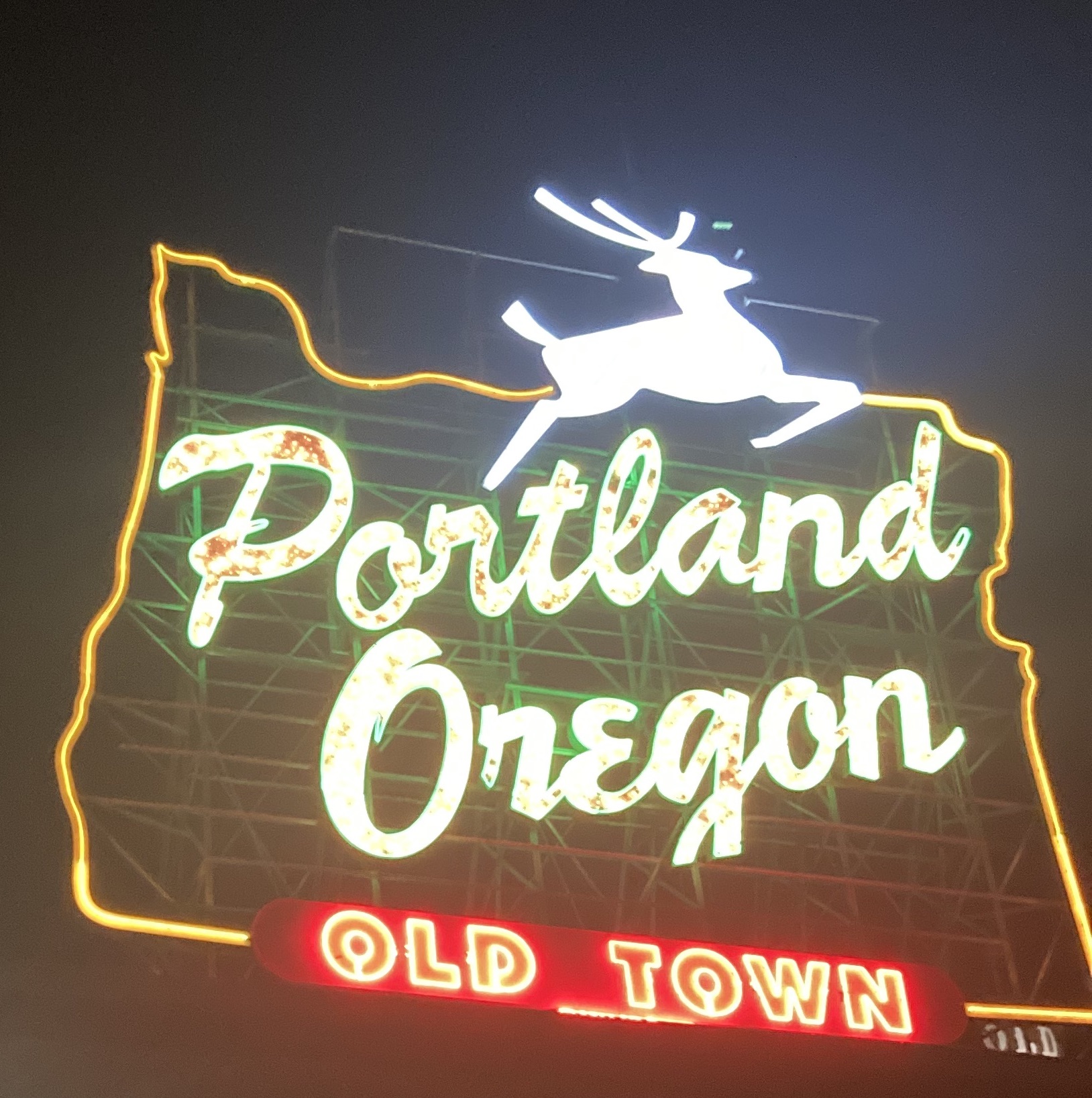

Last month, I made my way to Cleveland, Ohio for the first time. Yes, despite having been a four-year resident of the great state of Ohio, I had never been to Cleveland before. This trip was for a wedding (congrats to Reed & Annie!!), but I also – in typical fashion – found a few things that I think are worth expanding on. But before that, let me just say that I think Cleveland is a really great city to visit. It’s beautiful, interesting, and there are tons of nice people there.

Getting Situated
While the median traveler from Portland is likely to arrive to the Cleveland airport after a long flight, I made the choice to fly to Chicago to spend a day walking around before catching the 9:30 PM Lakeshore Limited to Cleveland. So I had the pleasure of arriving into the city at about 5 in the morning (the one time I wanted an Amtrak train to be a few hours late and they let me down).
The Cleveland Amtrak station isn’t much to write about. It’s near the lake, but not directly on it (a freeway and the Rock and Roll Hall of Fame get in the way) and the walk to downtown was annoyingly long. There is a light rail station next door, but it’s not currently operational (more on that later). And while a lakefront passenger station was a part of the historic passenger rail operations in Cleveland, city leaders pushed for consolidation at Union Station (now Tower City) – a move unpopular with the railroads as it required getting an electric locomotive and a diversion away from the main lines.

So it’s just an “Amshak” down by the lake. But luckily for us, the former Cleveland Union Station is the nexus of Cleveland’s surprisingly good and very interesting rapid transit system. Tower City is at the south end of downtown Cleveland, and the square outside (with the beautifully utilitarian name of “Public Square”) is the nexus of the RTA bus system too. So let’s take a tour through the annals of Cleveland history to learn a bit more about the transit layout of everyone’s favorite major city of everyone’s least favorite Great Lake (sorry Buffalo).
Cleveland Rapid Transit
The Cleveland rapid transit networks consists of three lines, or two depending on how you count the green/blue lines. Let’s say three, since that’s how the RTA designates them. The Red Line today resembles a metro – albeit one that runs entirely in main line rail rights of way, mostly the former Nickel Plate Road (now CSX) line. This is slightly unusual for a metro-style service, and the current service levels (about 4 trains an hour) and spartan stations make it feel more light rail than metro. But it’s entirely grade separated, and it has very metro style rolling stock!

The Green/Blue Lines share the old Nickel Plate approach from the east side of Cleveland, and a few stations, with the Red Line before branching off on a short viaduct to reach the median of Shaker Boulevard. From here, they run together until the Blue Line branches off down Van Aken. In short, they are a median running light rail/tram with a four and a half mile grade separated approach into downtown Cleveland. From an infrastructure standpoint, it’s all sort of surprisingly impressive. I say surprisingly because I don’t think anyone out here ever mentions Cleveland as a place that has a well-designed rail transit system.
In any case, the Green/Blue Lines are particularly interesting to me. While I didn’t get a chance to ride them while I was in town, their continued existence reminds me of this video about streetcars in San Francisco. In short, the continued existence of the J, K, L, M, and N is a result of grade separations that were necessary as a result of topographical constraints. The case in Cleveland is even more interesting though – since obviously there are little to no topographical constraints to deal with.
Rather, the existence of a grade-separated portion on what is now the Green/Blue Lines is a result of one of the most outlandish pieces of American railroad history: The Van Sweringen Brothers. In order to develop the leafy streetcar suburb of Shaker Heights, they created an early rapid transit system which required them to gain control of the Nickel Plate Road (for access to Downtown Cleveland). Eventually, they controlled something like $3B worth of railroads on the eve of the Depression mostly acquired on credit. Evidently, the Depression tanked their business but Shaker Heights and the rapid transit lines survived (including the predecessor to what is now the Red Line).

Thus, all three of the extant rail lines in Cleveland owe their existence to a very strange pair of brothers (who allegedly shared the same room in a mansion). But this isn’t the whole story, as other cities also had grade separated parts of a streetcar network (like Minneapolis-St. Paul, Rochester, and Los Angeles) but chose to scrap them. How Cleveland avoided this fate is – I think – a result of municipal ownership at a key moment in history. In the late 1950s, when the death knell came for most urban rail transit systems, Cleveland’s was municipally owned and operated (like San Francisco) and was thus able to leverage public funds to remain open. Perhaps the sole free market libertarian reading is upset about this, but I think it’s a good thing that Cleveland was able to invest relatively modest sums into maintaining an existing network rather than attempting to build a new one (as we are still trying to do here in Portland).
And as a final note, Cleveland has also expanded the system – though it remains in a weird game-day only post-Covid limbo now. The Green/Blue lines were extended from Tower City to the Waterfront – serving a trendy new urban infill area en route. Service only runs when the Browns play now apparently, but from what I saw the infrastructure seemed to be in good shape.
What is Light Rail, Anyways?
And the reason I think it’s so crucial is because modern light rail is essentially just the Cleveland model of rail transit. San Diego? Runs streetcar/tram inspired trains along main line rail tracks. Minneapolis-St. Paul? Runs streetcar/tram inspired trains along legacy interurban boulevards. Los Angeles? Runs streetcar/tram inspired trains along legacy interurban boulevards, and along former main line rail tracks. Portland? Runs streetcar/tram inspired trains along legacy interurban boulevards and in abandoned interurban rights of way. You get the idea. And it goes without saying that all of these systems are publicly owned too!
However, these systems are all worse than Cleveland’s in a key way. They don’t have any downtown grade separation (except for Los Angeles, but that’s new. And only partial – trains really crawl along Flower until they get to the tunnel portal at 11th). While we talk ourselves in circles about how important the MAX downtown tunnel is, what really matters is having a fast trip without the risk of being snarled in traffic. The tunnel is just one way to achieve this.

As we see in Cleveland, basically no part of the system is underground (excepting the Tower City Station – but this is building built on top of an at-grade rail terminal). The particular topology of the rail network in Cleveland plays a role in this, but I think it shows that we don’t always have to chose the most expensive option. Sometimes, we just need to buy a majority stake in a railroad on credit! Jokes aside, the need isn’t to do what the Van Sweringen Brothers did verbatim, but rather to leverage existing transportation corridors to build a rapid transit alignment.
And in this logic, we see the typical justification for light rail as well – it’s much less expensive to build along legacy transportation corridors than it is to tunnel underground. While most light rail systems in the US somehow manage to not follow their own original justification anymore, there is a key nugget of wisdom to retain from it.
Rethinking Portland’s Downtown Tunnel
There’s a popular picture that I’ve seen do the rounds lately. It’s a reasonable proposal, and if this was being built right now I’d be over the moon.

Of course, it’s not being built. It’s not even at the top of Metro’s High Capacity Transit planning list (though I do agree that TV Highway is worth investing in!). As such, we should be willing to consider other options. Here’s a quick sketch of what a route paralleling 405 through downtown (and thus leveraging existing transportation infrastructure) might look like.

While I-405 sort of misses the central part of Portland’s downtown (thankfully), I don’t think this is the end of the world. Yes, it would be less well served by the existing bus network – not directly serving Pioneer Square or even the transit mall at all. But if the Steel Bridge serving bus routes could be very minorly rerouted (to serve a Union Station rail stop), the only major bus route that would no longer connect directly the the MAX would be the 12-Sandy/Barbur (technically, the 14-Hawthorne too – but given that it terminates downtown an extension to a downtown stop near 14th and Main should be trivial). It’s unclear to me if there would be a huge need to rethink the 12 here – but changing how the two legs (Sandy and Barbur) are paired could rectify this without a huge lift.
All in all, do I think my plan is better? Not really – though it would offer an easy future connection to the Orange Line. But given that at some point, ODOT will look to reconstruct I-405, I think it’s worth having a less car-oriented option in mind. This isn’t even to say that I think I-405 needs to be replaced fully with this rail line (okay, I would support that too), it’s just that we ought to seriously consider what we actually need from a downtown MAX tunnel. If we are looking to parallel our existing system, then the first tunnel proposal is obviously better. But if we want to leverage the potential for ridership in the densest part of the state, as well as reflect a general north westerly movement of Portland’s downtown then I-405 is a genuinely interesting choice at least.

And still, the idea that new rail transit lines are most cost effective when following existing corridors that are suitable for them is a lesson that Portland needs to relearn. The older parts of the MAX system (pre Orange line) all reflect this. When there are compromises, like with station locations along the Banfield section, it’s usually due to the nature of the transportation corridor being followed. I feel that the Orange line, with it’s elevated bypasses of lightly used freight rail spurs and whatever is going on for the SE Tacoma station does a poor job of carrying this torch. But that’s besides the point. What matters more is where we look to for the future of our transportation system.
Where Do We Find Inspiration?
Another common refrain that I see is how Portland needs to take more notes from Vancouver, BC. I tend to agree, but I think it’s worth considering what sort of popular support a SkyTrain inspired solution for the MAX would really have. Part of the reason the original SkyTrain line was a success is owed to the repurposing of an old Canadian Pacific rail tunnel, along with an old interurban line to New Westminster. Yes, the elevated guideways and automated trains are great, but the thoughtful repurposing of old infrastructure is part of why the project worked too.

As much as I would love a Chicago style elevated metro in Portland, what I really want is as much metro style rail transit for as little money as we can spend. If that’s an elevated loop, I’ll be on it. If that’s a downtown subway, I’ll be on it. If that’s following I-405, I’ll be on it. I mean if it’s doing nothing and being stuck on a train going 5 mph over the Steel Bridge I’ll be on it for crying out loud.
But part of why I’ve found both planning school and the transportation advocacy world tiresome these days is just a lack of different places that we draw inspiration from. Cleveland is a great city, and I really was blown away by how good the public transit is – especially relative to my memory of riding the bus (very infrequently) in Columbus. If I never would have visited, I never would have learned how two strange brothers managed to gain control over a half dozen railroads all in the interest of getting streetcars from their suburban development downtown faster. Stories like this matter if you care about the state of cities in the US, and it would be nice to see this wider array of places referenced rather than just the Netherlands, Denmark, or Paris.

We have very different goals than this in a modern city, but that doesn’t mean that our ways of going about things need to be wholly different. We can still follow the path of least resistance, as long as we are clear what this means. The issue with urban freeway builders going that route was that “least resistance” meant bulldozing Black neighborhoods because they could not offer the same level of political resistance as White neighborhoods. The way to solve this problem is to lift up those who have been systematically dis-invested in, not to never build transportation projects in their historically logical alignments. It’s about redefining what “least resistance” means.
Thus, while railroads were at the forefront of many aspects of the moral rot which is consuming America, they also had limited ability to outright destroy existing urbanized places. As such, the ways in which they built within existing urban contexts are illustrative – and finding examples of the ways this was done are worth a closer inspection (especially in the context of the US, where urban history and railroad history are often one and the same).
Locally, when we consider “the path of least resistance” into getting a grade separated alignment for the MAX, we don’t even consider the possibility of how to involve anything owned by ODOT. It’s understandable, given the entire history of the organization, but I think it’s deeply unfortunate. The state department of transportation should be more than a highway department, but it never will be at the rate our region and state are going. That’s something to mourn, and to potentially organize around.
The Future: Interurbans as Crabs
Throughout history, crabs have evolved quite a few times. This example of convergent evolution has something to do with how the physical form of the crab is more flexible to many situations than that of a more lobster or shrimp like animal. So why do light rail systems tend to resemble the interurbans of yore? It’s all about flexibility. At their best, modern light rail services manage to travel long distances at reasonably high speeds (like the MAX Blue line having a 19 minute trip from Hillsboro Airport to Beaverton), while still being able to efficiently serve dense urban cores (like with Los Angeles’ Regional Connector). At their worst, they manage to do nothing very well other than be slow.

The impulse to deride modern light rail as bad because of its flexibility and formlessness is understandable, but ultimately it shows that a transit system is only as good as its design and operation. Having flexibility is a positive – but with great power comes great responsibility. It’s not enough to just toss down some median running rail tracks. If you do that, then you end up with situations like here in Portland where the transit mode of choice for the regional trip between Vancouver, WA and Portland is going to be a tram going 13 miles an hour down Interstate Ave.
This isn’t a knock on the Yellow Line – it’s a knock on the people championing it as a solution for regional travel in the still very car-oriented Portland metro region. If our modern interurbans are to reach their zenith, we need them to look more like the ones that survived in Cleveland than the ones that didn’t survive elsewhere. There are no legacy interurban or streetcar systems that survived to this day without public ownership and extensive grade separation. If the MAX is to survive into the 22nd century, we need to do something about the latter – and the approaches taken to solve the same problem 100 years ago may still bear fruit.

Leave a comment