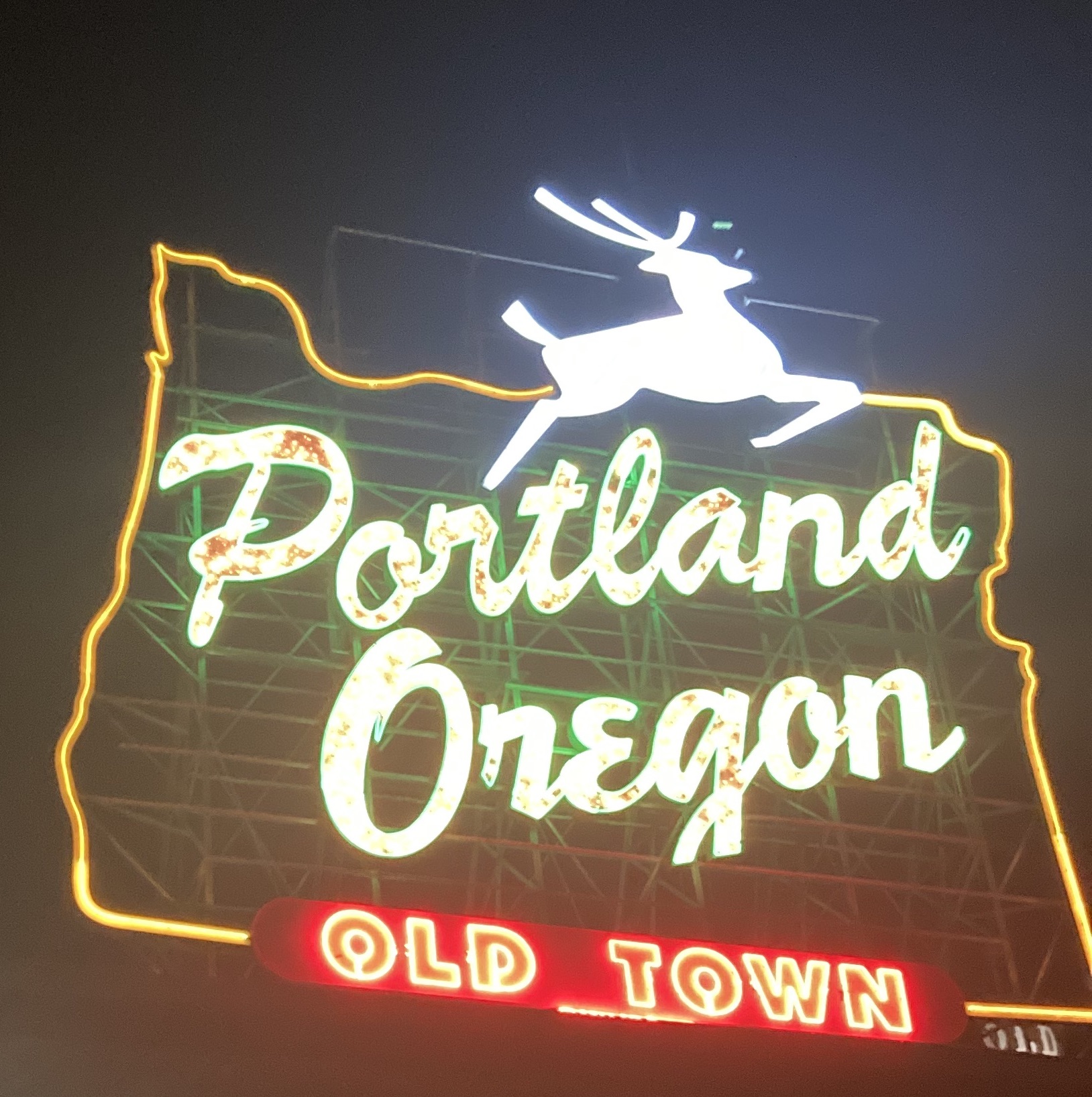

An outline of my next big project idea
Last week, in the PBOT/PSU Traffic and Transportation class, the deputy director of planning and development at Metro (a regional government for the Portland Metro area that has a boring name) was one of the speakers. She touched heavily on this map, and Metro’s land-use plans for 2040. I’m going to briefly go over my thoughts on the plan – and talk about some issues I have with it, as well as highlight a load of future walks in both the Regional and Town centers which Metro considers to be the future of growth in the region. For a bit of background, this plan originated in 1995 somewhat confusingly as a “50 year plan”. I’d say it’s a 45 year plan, but I don’t have a planning degree (yet!).
The 2040 plan has three different types of areas that I want to focus on
- Regional Centers are “hubs of commerce and local government services serving hundreds of thousands of people” and are colored darker purple. They are purported to “become the focus of transit and highway improvements”.
- Town Centers “provide services to tens of thousands within a two- to three-mile radius” with “a strong sense of community identity and are well served by transit”
- Main Streets are smaller scale town centers “with a strong sense of the immediate neighborhood” and “feature good access to transit”.
Plans like this (I think) are a little unwieldy to understand, so I want to break down each type of area using two examples – one good, one bad. These six different areas will be my first six walks around the area with land-use, the future, and sustainability in mind.
Regional Centers
Metro has eight regional centers highlighted: Gateway, Clackamas, Gresham, Hillsboro, Oregon City, Washington Square, Beaverton, and Tanasbourne. Keeping in mind that Metro thinks of these as places that serve “hundreds of thousands of people” let’s take a look at the most puzzling one – Washington Square.
Washington Square is a suburban shopping mall, centered on the Hall/Nimbus WES station. For those of you unfamiliar with the WES, it is a TriMet run commuter rail service along the old Oregon Electric and Southern Pacific Red Electric interurban right-of-ways which runs a grand total of 5 trains per direction per day, only on weekdays and only in the peak hour. Hall/Nimbus is the least used station on the system, with an average of 25 boardings per weekday.
The boundary of the regional center also has been gerrymandered to include a golf course. And while it’s technically possible that Metro intends to re-develop the golf course into a dense, walkable, mixed-use neighborhood I have my doubts based on the state of the Eastmoreland course in Portland. I also think it’s just generally a head-scratcher that Washington Square is a “regional center”, while the city of Tigard is a “town center”. Surely Tigard is more of a hub of local government than a weird hybrid of south Beaverton and North Tigard. And I’m fairly certain Tigard has better transit service on the number 12 alone than Washington Square does on any route – TriMet claims the 56 is “frequent service” but I think it branches from the 54, so only really has frequent service while still in Multnomah county.
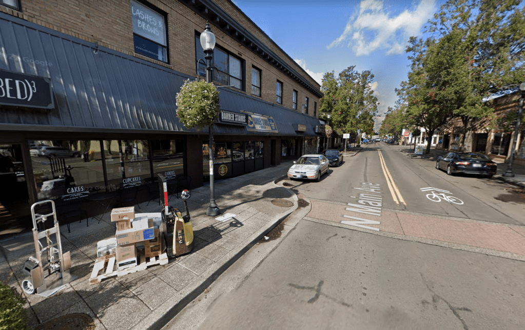
Anyways, a better example of a true “Regional Center” is Gresham. Gresham is the fourth largest city in Oregon, is an obvious hub of local government and services, and is actually served pretty well by transit.
Plus, downtown Gresham is fairly cute and walkable. I’d take the stretch of Main Ave between Powell and Burnside over anywhere in the Washington Square center by a country mile.

But a theme for “Regional Centers” more than anything is the proliferation of suburban, car-oriented uses (Main Ave Gresham non-withstanding perhaps). Gateway consists of two suburban shopping centers and a sea of parking, Clackamas Town Center is a mall with a sea of parking, Tanasbourne is – you guessed it – a subruban shopping and office center with a hilarious amount of parking. Maybe I’m being a bit too cynical, but seeing as Metro does not advertise a comprehensive guide for local municipalities to reduce parking footprints via infill, it’s hard to see how this plan meaningfully will change behavior.
And even if Metro does have that plan in the works – it’s still hardly moving the needle on livable, vibrant urban spaces. Full scale development projects get a lot of attention, but I’d like to see a much larger regional focus on smaller scale iterative changes to areas with a focus on small intensity improvements. In Strong Town, Charles Mahron notes that this focus on fully-fledged, ready-to-buy developments comes at the price of flexibility. If Metro’s investment plan for the Washington Square regional center doesn’t work out for whatever reason down the line, what happens to the money already spent? In a more iterative process, there isn’t really anything loss – the area keeps existing as it has. But with the type of development almost universally done in the US, the end result is usually a lifetime of maintenance on expensive infrastructure (roadway, rail, sewer, electric, etc.) to an area that doesn’t bring people together, and doesn’t make enough tax revenue to justify its own existence.
Town Centers
There are a lot more “Town Centers” identified by Metro than “Regional Centers” – I suppose for obvious reasons – so I won’t list them all out (they are available here). But the one I want to highlight as both good (and an interesting choice) is Hollywood.
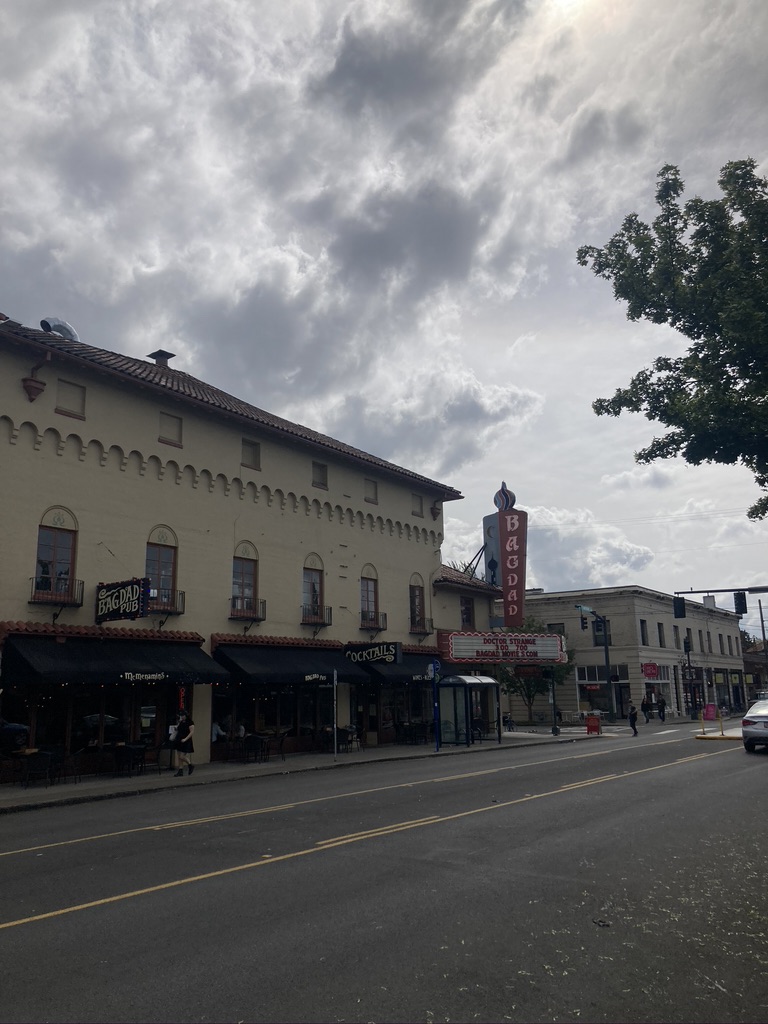
Hollywood is an old streetcar suburb, having coalesced into a neighborhood along stops on the Beaumont Line which ran down Sandy. Anchored by the Hollywood Theater, it survived the automobile age better than most – although ostentatious car-centric uses are pretty much the norm everywhere on Sandy still; and the surface parking lot remains king. I quite like the Hollywood area (I’m a Sandy Boulevard partisan), and I certainly think it warrants the honor of being a “Town Center”, but I want to touch on the car-centric uses abounding it.
Fully 13% of Hollywood is taken up by parking lots, and while the MAX stop and transit centers are big pluses – the reason it’s considered accessible to most people is more to do with its nearness to the Banfield Freeway than anything else. This freeway access attracts more traffic to the area, makes it less comfortable for pedestrians and cyclists, and generally makes it less pleasant. Which are all things I would not want for a “town center”.
No mater my quibbles with Hollywood, I can’t let Metro off easy here without a pass at the choices made with respect to Tigard. The shape of the Tigard Town Center area is very goofy, owing to the complete inclusion of the “Tigard Triangle”.
The Tigard Triangle is the Easternmost segment of the Town Center region, bounded by I5, OR217 and OR99W. According to the city of Tigard, it is a region characterized by a lack of sewer, sidewalks and other basic utilities – but brimming with “potential” due to its close-ness to two major freeways. So Tigard voters approved a tax-increment financing district (TIF) to use future debt to fund investment in the area. I won’t get too much into the details, but the city of Tigard has an FAQ, which answers the question “What is the difference between TIF and Urban Renewal?” to which they answer: “Essentially, they are the same thing … Unfortunately, in many areas urban renewal has had devastating consequences … in cities around the country, including Portland. For many, the term urban renewal evokes these past practices”. They just had to put a dig in to Portland there, well deserved I suppose.
I would posit that if you won’t call something by its proper name because of the “bad connotations” then it’s probably not worth doing. TIF (and Urban Renewal) are used as a way to “fuel growth”, which I am usually mildly skeptical of. Typically, benefits are overstated, while drawbacks are minimized and there is little to no meaningful opportunities for changing course. In other words, TIF is used to supercharge a development process to deliver a fully-fledged community, with little time to course-correct if things don’t work out so well. I am not familiar with the history of the Tigard Triangle specifically, but given land-development patterns (most of eastern Washington County was farmland until the suburban era), it seems obvious to me that the reason it hasn’t been developed into high-quality, mixed-used neighborhoods has less to do with funding and more to do with location.
In the end, Town Centers and Regional Centers almost entirely suffer from extremely car-centric design. The majority of them are suburban, with only four town centers and two regional centers (counting downtown) included within the city of Portland proper. And I think this is the crux of my frustration, the Portland area is pedestrian and bike friendly essentially exclusively within Portland. Metro’s focus on growth in the suburbs (and exurbs) therefore shows a huge preference to the type of development already there – car-centric. People move to suburbs for a variety of reasons, but cost of living is almost always near the top of the list. Everyday, people are forced out of more expensive, more walkable central neighborhoods into less expensive (by rent/mortgage), less walkable suburban neighborhoods. I am skeptical that investment in “centers” in suburbia really move the needle at all on this – affordable housing nearer to cultural centers (like Downtown) would be an order of magnitude more useful.
Main Streets
Main streets are pretty straightforward – commercial areas centered around a street. The quality of the main streets chosen by Metro vary wildly, ranging from strip malls on stroads to narrow former streetcar suburbs (and they left out quite a few of the really quality ones in Portland proper – more on that later).
Hawthorne Avenue is perhaps the quintessential main street in all of east Portland. Originating with one of the oldest Eastside suburban lines, the Hawthorne line ran over both Madison Street bridges (built in 1891 and 1900 respectively) as well as the current Hawthorne bridge (built 1910) – allowing suburban growth well east of the river. Nowadays, it is characterized by tons of trendy shops, grocery stores, bars, and restaurants – particularly the stretch between 30th and Cesar Chavez.


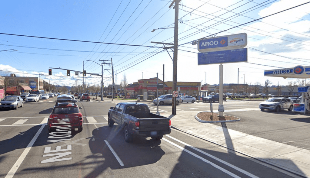
Contrasting this, Metro has also designated 102nd Ave in Gateway between Halsey and Stark as a Main Street corridor. Now, I’ve never actually walked this particular stretch (yet), but I know with 100% certainty that it will never be fair to compare it to Hawthorne. For one, 102nd in Gateway is a five lane road (with tiny tiny bike lanes) connecting the Gateway Shopping Center to Mall 205. A stroad between strip malls is not really the sort of place that people want to walk, bike or roll to.
Metro claims main streets have “a strong sense of the immediate neighborhood”. I guess if the neighborhood is a couple of strip malls with surface parking lots, then sure. But I would think that, given the opportunity, most of the neighborhood residents would prefer a lower-stress environment for their “main street”. Plus, I guess “traditional commercial identity” is rather ambiguous, and the US has a long tradition of ostentatiously car-centric design, but I still would think Metro (with their climate focused goals) would want to nurture places that are a little less private automobile focused.

Another annoyance for me, is that almost every single “Main Street” is also considered a “corridor” (defined as “major transportation routes for people and goods”). While it is fairly common for Americans to have commercial centers along busy roads, it’s worth considering if this is a good idea or not.

Almost all of the “high crash” streets are designated as a corridor by Metro, and are likely designated as a freight movement road as well by the pertinent government agencies. A good main street requires a lot of pedestrian activity, and by continuing to designate the best main streets as “major transportation routes… for goods”, Metro will make it practically impossible to ever fully pedestrianize them.
And I just want to finish off by touching on a few really important main streets that Metro did not designate in Portland.
- N. Williams – the center of historic Albina. It’s now entirely gentrified, but still retains a distinct Main Street feel. I was fairly surprised not to see it
- N. Mississippi – another historic Albina main street. Mississippi maybe gets less press than Williams, but as I understand it was also a central area of Black culture in Portland, especially after the Vanport Flood.
- SE Foster – from 52nd to 62nd(ish). Very strange that the Foster Main Street is not extended past a bit before Holgate. The entire street from 50th to 92nd is a bustling commercial district (or has the bones of one)
- SE 13th/Bybee – Sellwood. The route of the old Sellwood street car line turned onto Bybee from Milwaukie and down 13th and continues to be the center of commercial activity in the area. A real head scratcher.
- NE/SE 28th. Between Ash and Glisan – a really great area dating from the East Ankeny and Montavilla streetcar lines (ran from 1892 to 1948).
- SE Stark/Washington in Montavilla. To my eye, this is the central commercial area of the Montavilla neighborhood, although I am not entirely familiar with the area (I went to a bar out here on Stark once, and walked the area once).
- SE Grand/MLK in the Central Eastside. The heart of the Central Eastside, I can’t really understand this at all. There are tons of great historical buildings, and great service for transit. A big miss.
- Oregon City Main Street. Say what you will about Oregon City, but the Main Street is really nice. Not sure why it’s not here.
- Portland Ave in Gladstone. Designated as a “Town Center” instead, I don’t really get why though – it seems like a single corridor like that should be a street, rather than a Town Center. Maybe a bit of a silly hair to split.
I guess they can’t include every important main street in Portland (there really are so many), but including a random street connecting strip malls instead of places that already have a bonafide sense of place really shows where the priorities lie for Metro here. I guess a plan from 1995 should be taken with a huge grain of salt, but I still don’t understand some of the choices, particularly N Mississippi, N Williams, and 13th/Bybee.
I’m interested to see how this all goes, I am hoping to be pleasantly surprised with what I find with my boots on the ground; but ultimately, I’m feeling rather skeptical. I know Portland markets itself as a leader in planning and land use policy, but this plan doesn’t exactly move the needle much for me in terms of getting excited for the future. Stay tuned!

Leave a comment