Lately, there’s been a bit of chatter about the new “West Area Plan” in Madison. Enough outrage has been sparked (according to the Cap Times), that home owners are attending public meetings to boo planners. While the outrage would be easy to poke fun at (and I may end up indulging in some of that later), I think it’s worth starting with a bit of background on both the city of Madison, the West Side in particular, and what’s actually proposed in this plan.

Madison, WI
Other than being the hometown of the most thought-provoking blogger this side of the Appalachians, Madison primarily owes its existence to being the seat of the state government of Wisconsin. After moving around for a few years, Madison was chosen as a convenient point about halfway between Prairie du Chien (at the time an important river port on the Mississippi) and Milwaukee (a burgeoning port on Lake Michigan) thanks to some good old lobbying by an influential land owner who just happened to benefit massively from the development of what was a marshland along the Yahara River. In this sense, its a very typical US city – born out of vaguely corrupt land speculation, displacing existing Native Americans, and some good old fashioned swamp clearance. Physically located on an isthmus between Lake Mendota and Monona, Madison remained a relatively unimportant place in the state until after WWII, economically anyways.

In addition to housing the state government, Madison is also home to the flagship campus of the University of Wisconsin. Despite not going there, I’m quite fond of UW Madison and the campus is located on the west side of town – though the campus and directly surrounding neighborhoods are largely not a part of this new West Area Plan (which focuses on what I would consider to be the far West Side). UW Madison has been a vital part of the city since its inception, but the post WWII college boom coupled with post-industrial decline in the manufacturing centers of Milwaukee and Green Bay have left Madison as the fastest growing part of the state both in terms of jobs and people for the better part of the last 30 years.
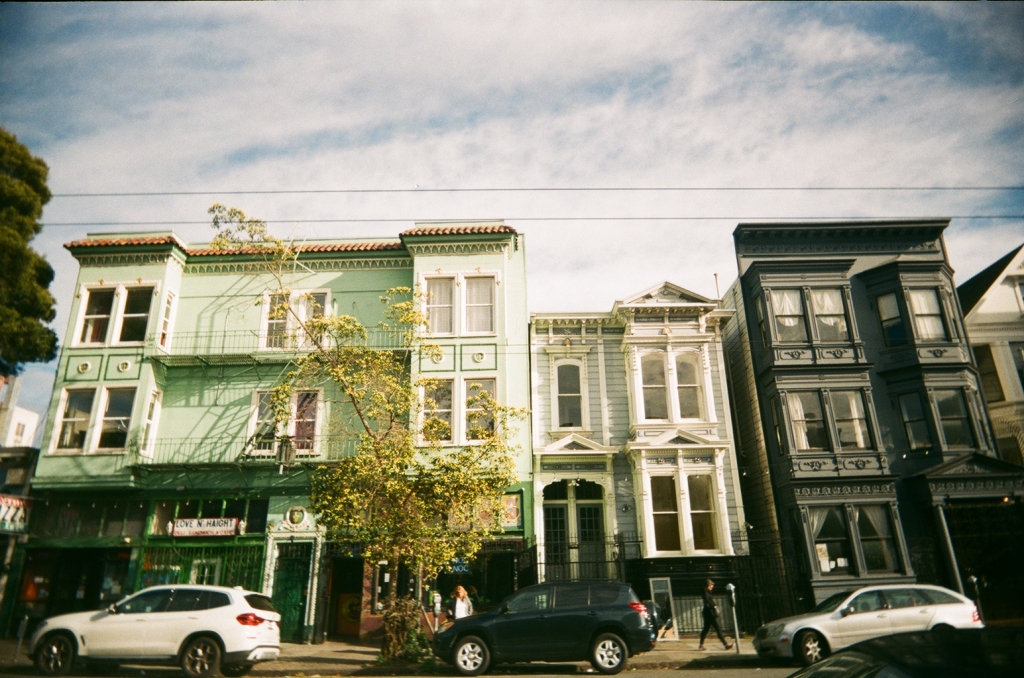
In terms of urban development, the story of Madison is largely similar to any other place in the US. Most of the inner city areas – bounded by Highland/Virginia Terrace in the west, Aberg to the north, Fair Oaks to the east, and Wingra Creek to the south – urbanized around a small three line streetcar network, and those areas were largely built out by the 1930s. The particular geometry of the city (with downtown being more westerly on the isthmus) meant that while the total area of urbanized land on the east and west sides were similar in the 1930s, the east side stretched further from downtown. With the acceleration of automobile ownership and use in the 1940s and beyond, the west side “benefited” relatively more from having larger amounts of land closer in to the city center – and given that UW-Madison’s campus also lies west of downtown, this lesser distance meant that west Madison took on a much more suburban character than east Madison.

There were other factors as well – the concentration of railroad and manufacturing businesses on the east side of town (like the now shuttered Oscar Mayer plant) gave it a working class character, while the aforementioned public institutions and university jobs gave the west side a more white collar character (generally anyways).
The Far (West) Side

And so the entirety of what is now considered to be the West Side of Madison developed more or less entirely as a car oriented suburb from the 1950s onward. If you read much about urban planning history, you are likely aware of the problematic nature of suburban development in the post war era being explicitly gated by race and Madison was not an exception to this. In fact, this is still somewhat evident in the demographics presented in the plan itself – median household incomes are 17% higher than the city as a whole, and the area is whiter than the city as a whole. That’s not to say the far west side of Madison is currently filled with racist rich homeowners (I know for a fact that it’s not!), just that is the historical context of urban development in the area.

On a personal note, I spent a fair amount of my childhood on the far west side of town. While my childhood home was on the fringe of urban development in the 1930s, my middle school (Hamilton) was in a neighborhood largely built in the 1960s, and much of my life as a swimmer was spent on the suburban far west side owing to the suburban nature of the sport. And many of my friends lived further west as well – primarily around the Hill Farm neighborhood. As an adult, one of my friends lived in an apartment off Mineral Point and a dear childhood friend and his lovely wife bought a house a stones throw from my middle school as well.
The point being is that I feel comfortable talking about the far west side as a local, even if I’m from the other side of the Midvale as it were.
Zoning, Land Use, and Bureaucracy
Anyways, my first exposure to this topic came when my friend Michael shared an opinion piece with me about how “City Hall is taking aim at Madison homeowners“. After giving it a read, I typed out a long winded response to Michael about how the current housing dynamics in Madison will require either extreme amounts of sprawl or densification of much of the core of Madison (like in my own childhood neighborhood). I feel that Hill Farm is likely close enough in to see some of that, but targeting the pool specifically is a poor choice from the city. But on a second read, and after getting a grip on both Madison’s zoning code and it’s generalized future land use designations I feel that this piece deeply misrepresents the changes being floated in the West Area Plan.

Let’s start by looking at one quote from this opinion piece.
“Tishler, who represents the west side’s 11th District that includes Hill Farms on the Madison City Council, told me the city’s “draft west area plan” would rezone that tract of land”
Paul Fanlund, Cap Times Publisher
This is not exactly true. While the West Area Plan does change a land use designation on the tract of land including Hill Farm it is changing it’s “Generalized Future Land Use” – not its zoning. While this is a very esoteric difference, it really just means that the city is identifying it as a parcel that might be upzoned in the future – not one that will be upzoned now. And while the author uses the terrifying specter of mutlifamily housing in a quiet single family home neighborhood, in reality Hill Farm is also home to quite a few existing apartment complexes – some of which are a block away from the pool.
As a brief aside, there’s something ironic about there being a genuine housing crisis and the bulk of a plan to address it relies on updating a Generalized Future Land Use designation for lots of parcels – but not actually changing the zoning on them now. So I guess we can be happy that at some point in the future, maybe more development capacity will exist. Just not right now – I guess it’s only a minor crisis?
The West Area Plan does change the tract containing Hill Farm Swim Club from “low density residential” to “medium density residential”. What does this mean? Well low density residential is defined as having 15 or fewer dwelling units per acre in 1 to 2 story buildings, while medium density residential is defined as having 20 to 90 dwelling units per acre in 2 to 5 story buildings. Our opinion piece mentions that a developer would likely pursue maximum density, and insinuates malicious intent on their part but let’s take a closer look at the economic realities faced for a parcel like the one Hill Farms is on.
(fair warning, discussion of specific pieces of the zoning code and land prices follow)
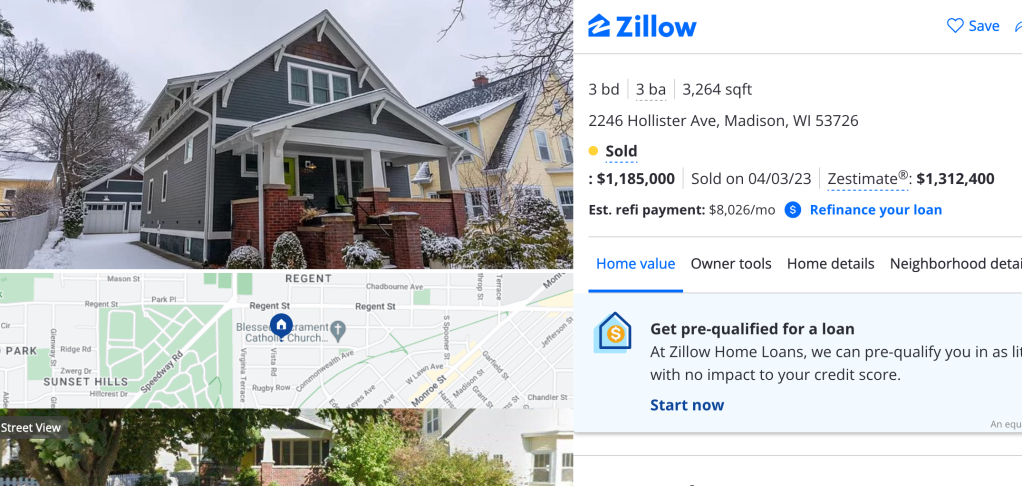
The parcel which Hill Farm is on is currently zoned SR-C1 (suburban residential), which comes with 8,000 square foot minimum lot sizes (about 1/5 acre), though most of the adjacent lots are closer to 10,000 square feet. There’s a maximum lot coverage of 50%, and a two story height maximum. If we were to maximally subdivide the lot Hill Farms is located on (it’s just over 100,000 square feet), we could get 13 lots which could be developed into new single family homes. While Hill Farms is currently assessed to be on just under $350,000 of land ($3.30/square foot), prevailing land prices on nearby Door Drive imply land prices of over $12/square foot. I won’t dwell on that discrepancy – since I think it’s fine that community resources like pools pay lower property taxes anyways – but it does mean that just buying the land would cost somewhere in the neighborhood over $1.3 million. $100,000 per unit land prices are just not something that lend themselves to the development of anything other than luxury housing. Newly built houses with similar zoning on similarly valued land sell for between $400,000 and $750,000 – in locations likely less desirable than across the street from a lovely park and close to transit and biking routes to UW-Madison.
A future upzoning would likely bring the area into SR-V2 (given its location and my rudimentary understanding of the Madison zoning code), which allows up to 24 units/lot on a 1,500 square feet/dwelling unit minimum lot and 60% maximum lot coverage. Alternatively, 8 units/lot on the same 1,500 square feet/unit can be done on 90% lot coverage. In this scenario, we can subdivide our 100,000 square foot lot as much as we please so lot coverage is ultimately what governs how dense a development can be. At most, an SR-V2 zone would allow for 62 units to be developed on this parcel – meaning per unit land prices of about $21,000. Keep in mind that this isn’t a real scenario, but the overall density would be 25 units/acre compared to just over 5 allowed by the current zoning code.

I don’t want Hill Farms to be redeveloped, so perhaps this exercise has been a moot point. As an alumnus of the All City Swim League, I think the city should really be trying harder to expand the league outside of its gated private pool origins. On that note, I’d support a full property tax exemption for all pools in the All City League on the condition that proceeds from the yearly All City meet go towards building new public pools in the near east side, south side, and downtown neighborhoods that have the worst pool access currently (along with more robust affordability measures for membership at each pool). But the point is that existing zoning – especially in the SR-C1 and TR-C1 parts of the city – is a huge part of what is driving unaffordability by keeping densities lower than what likely would be built otherwise.
The city will be wholly unable to address this if it continues to use its zoning code to enforce a 15 unit/acre maximum density (which really looks like 5 to 10 units/acre in practice) on so much of its residential land. Just how much, you ask? Well according to my calculations based on existing Generalized Future Land Use data from the city, two thirds of all residential land in the city has a future designation of Low Density Residential. As a reminder, per unit land costs are 5 times higher in these areas than they are in medium density residential areas.
| Generalized Land Use | Proportion of Residential Land |
| Low Residential | 66.7% |
| Low-Medium Residential | 12.4% |
| Medium Residential | 10.5% |
| Community Mixed Use | 4.6% |
| Neighborhood Mixed Use | 2.5% |
| Regional Mixed Use | 1.9% |
| High Residential | 0.7% |
| Downtown Core | 0.4% |
| Downtown Mixed Use | 0.3% |
Yes, higher intensity developments are more expensive in absolute terms – obviously a larger building costs more. But in per unit terms, having more units means that fixed costs (like land, sewage, etc.) are relatively less of the overall developments cost. In sum, this means that higher density tends to lead to lower per unit costs (though in the real world things are so much more complex than this – especially when the intersection of building codes and zoning codes requires land use law experts to even float a development that stands a chance of actually being built). There can be a particularly pernicious arrangement where difficult to understand zoning and building codes raise the cost of entry into the already difficult to enter development field, thus giving large scale developers a vested interest in the status quo.
And on a final note for this opinion piece, if you are saying something like this: “My point is that whether the housing shortage is any more a “crisis” today than it has been through previous decades”, you need to get a grip. Madison’s housing crisis is not something that can be waived away through some bland appeal to the past. It’s very real, and people I know are being pushed further from the walkable, bikeable urban core and into suburbia while other folks are priced out of the city entirely.
Wait So What’s Even In The Plan?
The plan for West Madison is not very bold to put it mildly. There are just five parcels that have planned “proactive upzones”. Let’s go over them one by one.
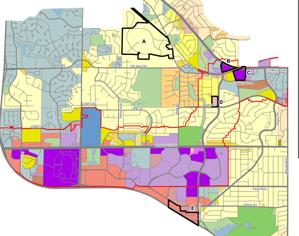
Parcel A is a region currently zoned TR-R (Traditional Residential – Rustic), what might be the least dense development designation in the zoning code. 0.6 acre minimum lot sizes mean prevailing densities are in the 1 to 2 units/acre range. It’s a pretty part of town with a lot of trees, and the sort of place where a house will cost you well over $1 million. The whole area is about 130 acres, and shifting from TR-R to SR-C1 (~5 units/acre) means adding the capacity to develop all of 400 to 500 new single family houses. At prevailing household sizes of 2.5, this means 1,000 to 1,250 new residents could potentially move in. Given that I’ve already gone over how new SR-C1 zoned developments are unlikely to be even remotely affordable you’ll forgive me for not commenting further on this.
Parcels B and C are set to be upzoned from NMX (neighborhood mixed use) and SE (suburban employment) to RMX (regional mixed use). This is sort of interesting, mostly since there aren’t many RMX zones in the city, and none of them really inspire much joy in me (West Town Mall… cool!). It allows for 2 to 5 stories, and the zoning code hopes that they “should be the most intensively developed areas in the city outside of the downtown.” I find that to be sort of interesting given that the places currently zoned for RMX don’t really come to mind as “intense uses”, and are mostly suburban oriented shopping centers. I would be surprised if this change was enough to get the neighbors up in arms.

Parcel D is probably the most interesting (and contentious) the of five. It is currently zoned SR-C2 (suburban residential) and contains two churches and eight detached single family houses. Being upzoned to NMX (neighborhood mixed use) means allowing for developments similar to the Trader Joe’s building on the corner of Monroe and Harrison (but slightly smaller, with a three story max height)*, which generated at least some controversy while being built back when I was in elementary school. A neighbor who spoke on the development back then said that they “strongly feel that the five-story height, scale and bulk of the proposed building is too large for its surroundings and the neighborhood”. The building itself is unremarkable to me, and surely the benefits of having a Trader Joe’s there far outweigh the “downsides” of having a larger condo building. Maybe I’m in the minority, but I’m personally glad that a one bed condo in that building (estimated at $350k) exists to fill a need not met by the $500k plus detached houses in the area.
*technically, this is in a “Planned Development” zoned area and while it’s slightly taller and bulkier than what is allowed by right in a Neighborhood Mixed Use zone. But I feel that it’s a good example of the vibe planners go for with this kind of zone.
Fully redeveloping this parcel (it’s about 7 acres) at maximum allowed residential densities would create something in the neighborhood of 450 units (with the relevant regulation in the NMX zone being 500 square feet of lot required per unit on 75% lot coverage). It feels significant to me that the city can add the same number of new units on a 7 acre parcel here as it can on a 130 acre parcel further north. That’s another 1,000 to 1,250 people living within walking distance of Hill Farm Swim Club too – which has to be a good thing for the constantly struggling pools bottom line.
And finally Parcel E is being changed from CC-T (Commercial Corridor – Transitional) to CC (Commercial Center). If there’s anyone who is up in arms about this zoning change, I have no idea what to say to you.
It’s Not Just Current Zoning, What About Future Zoning!
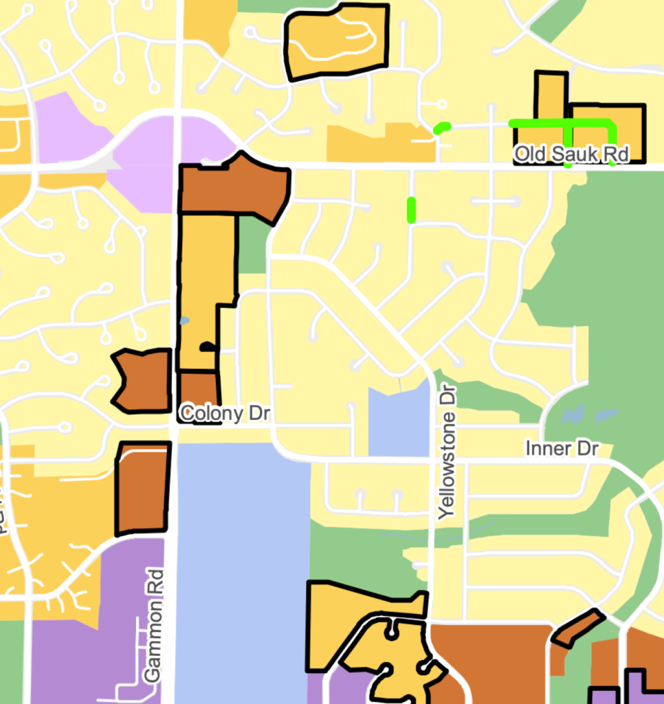
Of course, it’s not just current zoning changes – there are also a fair number of changes to the Generalized Future Land Use designations (which are different than zoning!). There are a whole lot more of these changes, so we won’t go through them one by one. What I do want to highlight is how at least by area, most of the changes are not within existing low density zoned areas.

The area with likely the most substantial change is centered around Gammon Road, in the vicinity of Old Sauk and Memorial High School. For all of these areas outlined in dark black, the shift represents moving one step up the scale (from Low to Low-Medium, and from Low-Medium to Medium). The difference between Low and Low-Medium is, in my opinion, not interesting. Low-Medium density is still not dense by urban standards, and having lived in an apartment in both Low and Low-Medium density areas I could not tell you what the actual difference is in terms of built environment. I liked the Low-Medium area a bit more, but I walked to the same grocery store from each place (shout out to the Jenifer Street Market).
Perhaps this is all splitting hairs, but if you don’t have a firm understanding of what the existing zoning and land use regulations mean in practice for the city then how exactly are you supposed to meaningfully understand what the changes are actually going to do? If you rely on neighborhood sources, you’re likely to find fiery opposition to the idea that anything other than a single family home on a quarter acre lot is “appropriate” for the area. If you rely on internet personalities (other than myself of course) you’re likely to find free market absolutists disguising themselves as humble reformers. Absolutists like M. Nolan Gray “who would like to abolish pretty much all zoning … everywhere, so far as I can tell” (the words of that opinion piece) are certainly right about some aspects of the zoning code and it’s history in the US (or I presume anyways, he blocked me on Twitter for saying his comparison between Madison and Washington DC was lazy and bad). But imagining that we can free market our way out of a socially constructed problem is just never going to be something I can get on board with.
That being said, Madison should categorically not be planning for prevailing residential densities in the 5 to 15 units/acre range. The city has already reached crisis levels for housing, and needs to be build a whole lot more to keep up with projected job and population growth. How might we address this?
What Is To Be Done?
For starters, the city should really do away with the differences between generalized future land use and zoning. It’s confusing mostly serves to illustrate how needlessly complex the zoning code is. Rethinking the zoning code to match the categories in the generalized future land use would do a lot of good, and would likely serve to reduce confusion. Additionally, we just cannot be planning for less than 15 units per acre anywhere – much less for more than two thirds of the residentially zoned land in the city. Madison is a city, and if the zoning code exists to fight against natural patterns of human behavior that come with that it will be fighting a losing battle.
I’d also reiterate that this plan should be protecting existing community spaces, not attempting to redevelop them. Hill Farm is the most egregious example for me, but many of the other future land use density increases are churches. In fact, I can’t find an example of a church in the West Plan Area that didn’t get a future land use density increase. If the city is hoping that upzoning with increase development pressure via increased land values churches are a uniquely poor choice for using this mechanism, given that they don’t pay property taxes. Maybe they are hoping the churches will engage with developers on developing some segment of their land, while retaining the church building – something I’ve heard chatter about in Oregon. If they are, there should probably be some discussion of that in the plan.
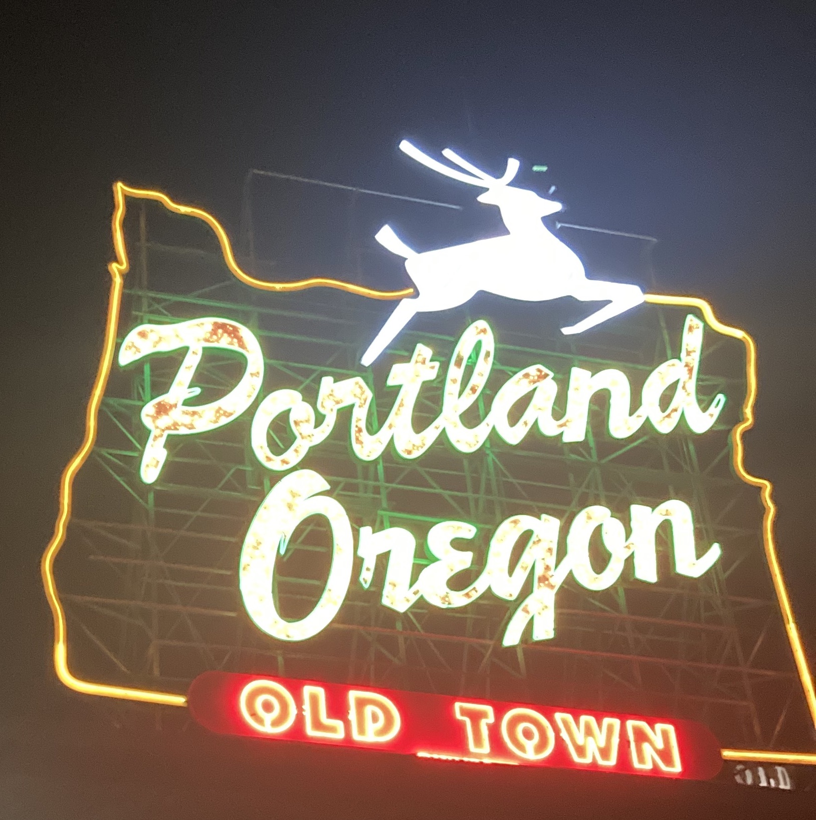
Critics of this plan point to platitudes about community cohesion, and I’m sensitive to that. I’ve lived in soulless apartments with no sense of community – but I was able to afford a place close in to central Portland that was a 10 minute walk from some of my best friends in the world. My community largely existed outside of my immediate neighbors. Additionally, not all apartments have to be designed in such a bland way. Simplifying the zoning code could allow for new developments to fit the feel of the apartment I currently live in (10 total units, facing an internal courtyard). That’s not to say that developers will solve problems of community cohesion, just that our existing zoning code only really allows for it in single family homes.

If you believe that community can’t be found in dense cities, I’ll ask you this – who has more pride about the place they’re from, people from New York, Chicago, or Boston or folks from Stamford, Naperville, or Lexington? Community might look different in urban places than suburban ones, but that doesn’t mean it’s not there. Ultimately, healthy societies can be found in any type of dwelling arrangement; density is not a sin that cities inherited from the Devil, to be juxtaposed with the quaint pastoralism of the country estate. Rather, density is what allows for cities to be vibrant and interesting places.
And sure, some kind of regulation on density is a broadly good idea, but we need to get beyond the draconian and anti-urban regulations that have come since the advent of the automotive age. The inextricable link between transportation and land use means that planning for low densities also amounts to planning for automobile use – if Madison wants to remain bikeable it needs to actually plan for people to be able to live in the bikeable core of the city. The reason lots of people bike to work from the near east and west sides is that it’s not very far, and that the ride is probably a pleasant one on a bike path. It’s laughable to imagine that we will be able to create that situation while planning for 5 houses/acre on a street grid that looks like spaghetti.
This Plan Won’t Get Us There
When it comes down to it, the issue I have with the West Area Plan is that it’s nowhere near bold enough. Fighting homeowners associations over marginal density increases on the corner of Old Sauk and Gammon isn’t just bad politics, it’s bad planning too. The parts of the West Area that really need more density are left almost totally untouched by this plan. The 350 acre area bounded by Whitney Way, Mineral Point, Midvale, and Regent is seeing just three proactive changes to future land use (up to Medium Density), all on one of the main border roads and amounting to just 6 acres. This is in spite of the fact that it’s very well located – less than a 15 minute bike ride from a main regional hospital, UW-Madison, and the major employment center at Research Park. It’s also centered on a middle school and elementary school.
The changes will allow for about 200 to 300 more units to be developed, to complement the roughly 1,750 existing detached homes. And sure, this would be nice – if the land identified was even remotely developable. Instead, it’s home to two churches and an older mutli family complex on Hillcrest Drive. Is encouraging the redevelopment of existing multi family housing smart policy? I’d lean no. Is preemptively upzoning places where people don’t live, but where they find community (like a community pool or church) smart policy? Again, I’d lean no.
Practically speaking, if I was seeking to increase density targeting churches and community pools would be the last thing on my mind. It’s politically fraught, and it’s bad policy to boot. What’s more, the plan does nothing to address some frankly shocking data around how residential land is utilized. According to the plan, “only 1% [of residential land is] zoned for 2 to 4 dwelling units and 5% zoned for multi-family housing” – leaving 95% of residential land being both zoned and used for single family housing. This is despite the fact that a minority of housing units on the far west side are single family homes – just 42%. Having 58% of housing units occupying 5% of the land is atrocious policy – and this plan mentions this and then does hardly anything to act on it.
Put another way, if the 300,000 or so housing units in the metro area all had to comply with a 5 unit/acre density spelled called for by the SR-C1 zones that predominate the far West Side, just the residential land required to house those 300,000 units would take up an area 50% larger than the Boundary Waters.

We touched on how little of the land is being meaningfully rezoned now but it’s worth repeating that only 7 acres out of 2,400 will allow new multi family buildings now, and it’s on a major-ish road. This will do nothing to address the current inequitable policy of “apartments only on major roads where homeowners can’t see them”. And even this nothing isn’t enough to assuage the fears of suburban homeowners, because nothing can. In a lot of ways, the fears expressed by homeowners – of neighborhood change, of “over development”, of the desire to continue the segregation of residential and commercial uses – are real, but also antithetical to living in a city at all.
Change is constant in life, and neighborhoods do not get an exemption from this. The part of town I grew up in is now part of the second wealthiest census tract in the state, with a median income of $196,000/year (yes, you read that correctly). When we moved to the tract when I was 3, it was the 746th wealthiest census tract in the state and the 71st wealthiest in Dane County with a median income of $39,000/year (or ~$66,000 in 2022 dollars). All of this happened in a context where exclusive single family home zoning predominated.
So many of the things I have been in my life came about because of where I lived. My friends, my sense of self, and my entire world are rooted in what it was like to grow up on Virginia Terrace. I feel a sense of grief, anguish, and disgust that so many people are unable to access the same kind of comfort, joy, and stability I had as a child. Seeing my neighborhood go from median income to more than 250% of median income over the span of my short life is disarming.
But our current plans don’t just make this inevitable, they actively cause it to happen. Without any measure to allow for densification and correspondingly lower per unit prices, the only option has been higher prices leading to higher prices, and everyone who isn’t either working in tech or already living there being priced out. And this is why I react with such disgust to reports of such vitriol to a plan which doesn’t go nearly far enough. Every city planning decision bends over backwards to ensure that they do everything to prevent the horror of a three flat going in down the road, or a cottage court, or even (gasp) a 30 unit behemoth from marring the quiet streets of [insert your neighborhood here].
It’s worth asking – would this be so bad? Would it be some horrific fate if homeowners in Madison were forced to live next to a 4 story apartment building? Because the other option won’t cut it. I can’t sit idly by and watch a place that I love so dearly work itself into fits about how horrible it would be if I moved there now. I certainly can’t afford a single family home down the road from where I grew up now, but I have a chance of being able to afford a condo like the ones on Monroe Street, or of renting a flat. Is neighborhood character really more important to you than an affordable place for your children to move to? How does the character of the neighborhood change when working families are priced out and forced to live in 20 miles away on a former dairy farm?
The housing affordability crisis will not be solved until the underlying issues of anti-density, and anti-urban policies are undone from the peak of the automotive age. And if you’re in Madison, please speak out about this plan. Voice careful criticisms (particularly around the lack of care for expressed for neighborhood community pillars), but be sure to highlight specifics of the plan that you support. And remember, organizing to exclude multi family housing from your neighborhood is tantamount to organizing to exclude lower income families from your neighborhood too.

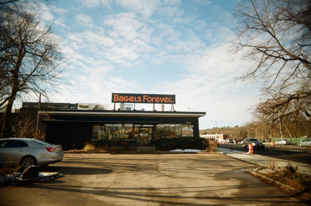
You can’t prevent the change that has come to Madison, but you can work to preserve what really matters in the city. You can work to make sure that everyone who wants to live here can find a relatively affordable apartment to rent, while ensuring that places like Hill Farm Swim Club survive into perpetuity. The things I cherish about Madison are my friends, family, and the memories of a summer walk from Shorewood to Bagels Forever. Regardless of what sort of housing you live in, you deserve to have those things too.
The road may be long and rocky, but as a noted Madison West Cross Country coach used to say: “You can’t get there without getting there.”
Sources, Further Reading, and More
- Current draft of West Area Plan
- Madison’s Zoning Code
- City of Madison Generalized Future Land Use map
- Cap Times piece on neighborhood reaction
- Cap Times opinion piece
- City of Madison property tax data
- A very insightful piece on housing affordability from someone smarter than me
- Thank you to my dear friends Jack Englehardt and Sarah O’Keefe for their insights as to how folks in the neighborhood feel about this plan

Leave a comment